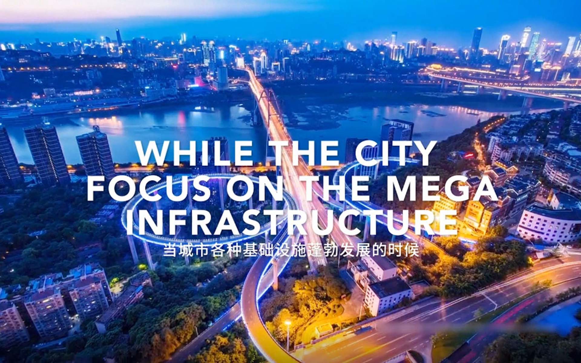
The key issues of this project is to find out a variety of treatment for the outstanding ecological landscape problems of Jialing river bank, including the serious ecological degradation of the fluctuating zone, the design and utilization of the space under the bridge, the impact of the 20 meters seasonal water level change on the environment, and the optimal design of the retaining walls. At the same time, the landscape design of the riverside shoreline should strengthen the connection with the hinterland function and the tourism planning, optimize the public space and service facilities, and enhance the accessibility of the riverfront.
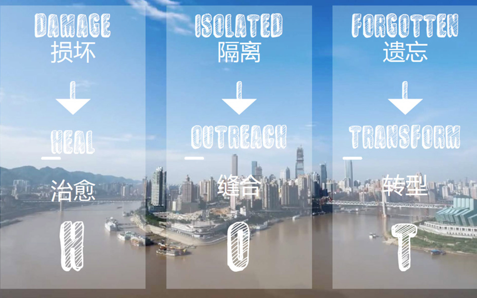
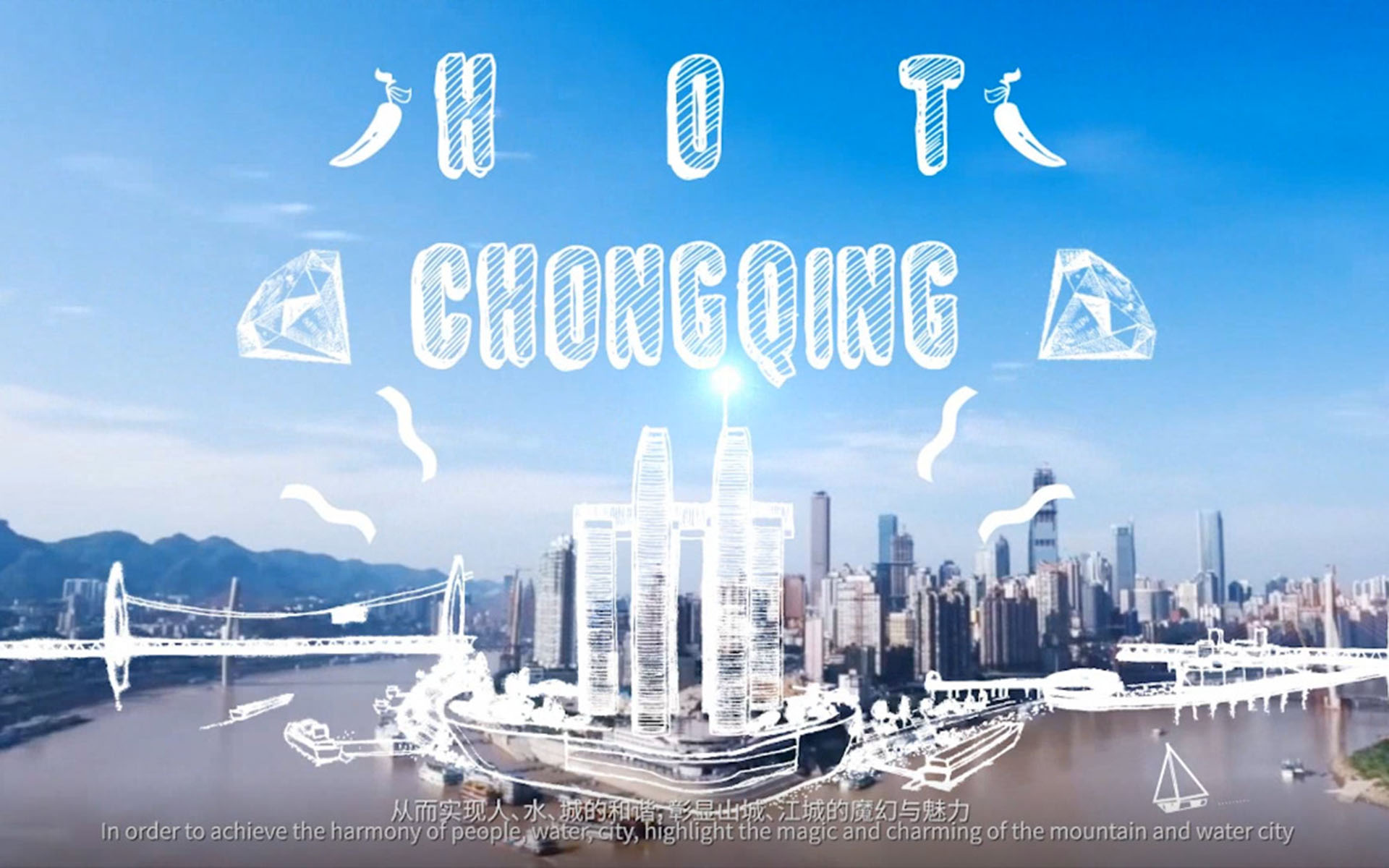
DESIGN CONCEPT---“ H.O.T”
After several site visits, we tried to improve the landscape spaces of Jialing River by three planning strategies:
Repair of damaged neglected eco-systems so that nature can regenerate urban functions. Reconnect the urban living spaces with river line, efficiently connecting city and nature; Upgrade the neglected riverside landscape, activate the riverside’s activity space, and inject vitality. This will unify the residents, visitors, river environment as well as highlight the magic and charm of the “mountain and water” city.
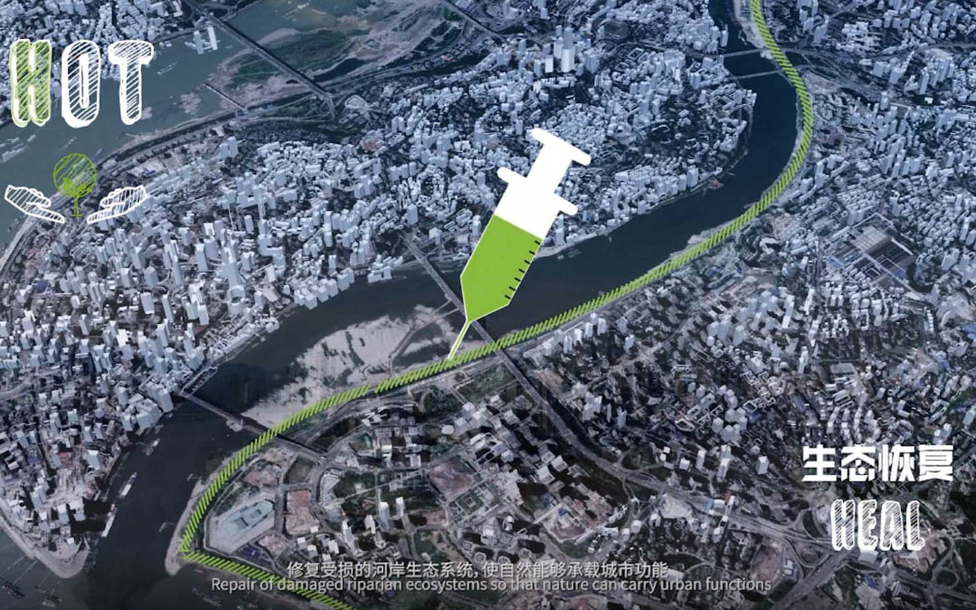
HEAL-- ECOLOGICAL RESTORATION
Chongqing's unique ecological location has represented a harmonious symbiosis of mountain, water, and city for thousands of years.
As a result of the construction of the Three Gorges Dam, the Chongqing section of Jialing River has dual attributes of a natural waterway and a reservoir. This also leads to the change of the periodic water level during the summer flood of Jialing River and the anti-season in winter. This change of the original hydrological situation has created a large area of exposed spaces as a fluctuation zone.
At the same time, large-scale elevated roads, wharfs, drainages and other infrastructure occupied the original natural ecological space, forming an excessively artificial riverbank. This led to the crisis of an ecological imbalance along Jialing River, which is embodied in the ecological problems such as periodic drastic changes of the water level, ecological degradation of the fluctuation zone, or water pollution caused by the confluence of rain and dirt at an over-artificial shoreline.
So we propose the concept and goal of ecological rebalancing – designing ecological landscapes based on the changing river ecosystem, which in turn can gradually recover the degraded ecological environment and form an adaptive riverside landscape system.
In the vertical direction, according to the hydrological conditions, the riverbank space is divided into five levels and four distinct parallel riverside spaces. In addition, we also focused on the causes of ecological degradation within the water-fluctuation zone, and proposed 4 major ecological restoration strategies: a substrate repair strategy; irrigation strategy combined with rainwater discharge; hierarchical landscape processing strategy; and seasonal planting strategies. We have further summarized an ecological restoration toolbox, containing vertical purification wetlands, riverfront ecological agriculture, landscape art, floating wetlands and many ways. According to the different conditions of the riverbank, people can choose the right combination of tools for ecological restoration.
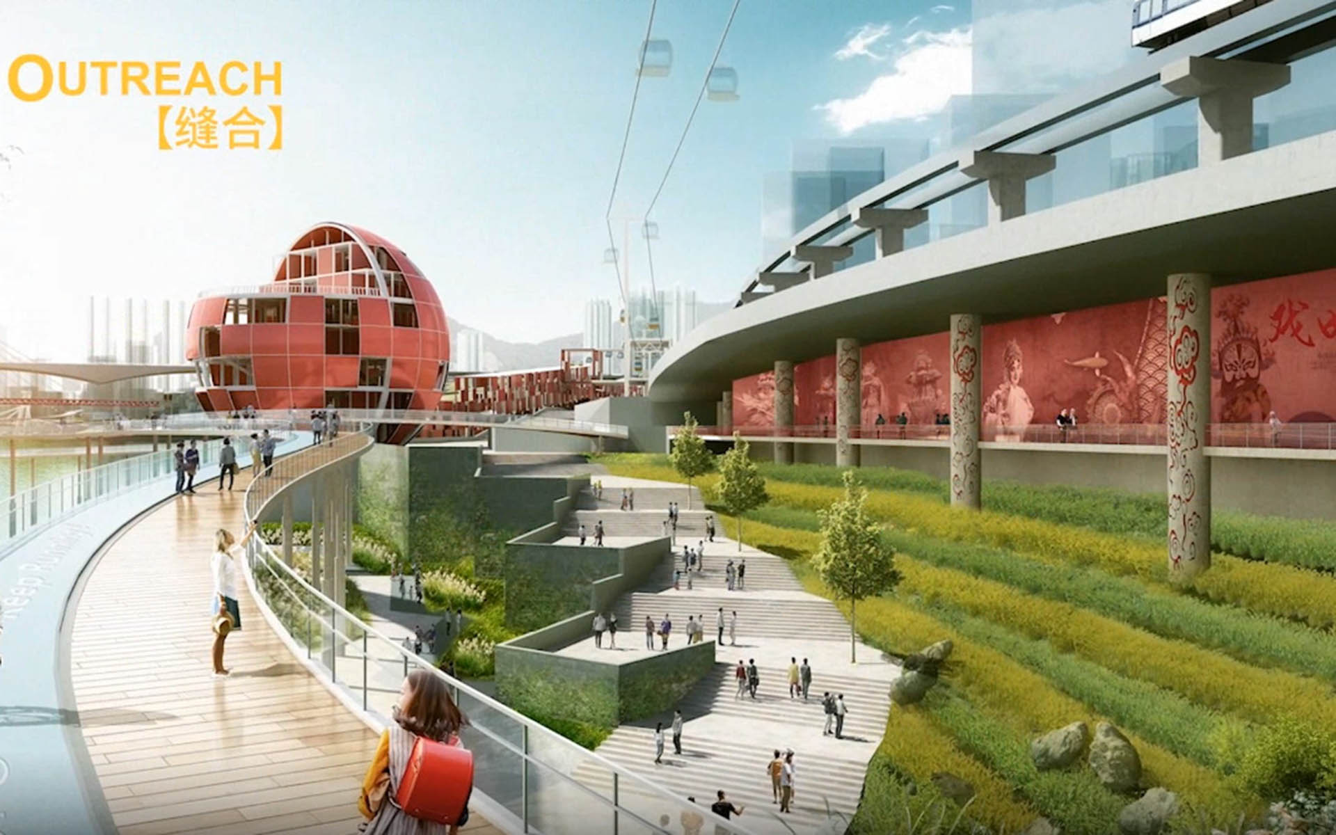
Outreach -- ACCESSIBLE WATERFRONT
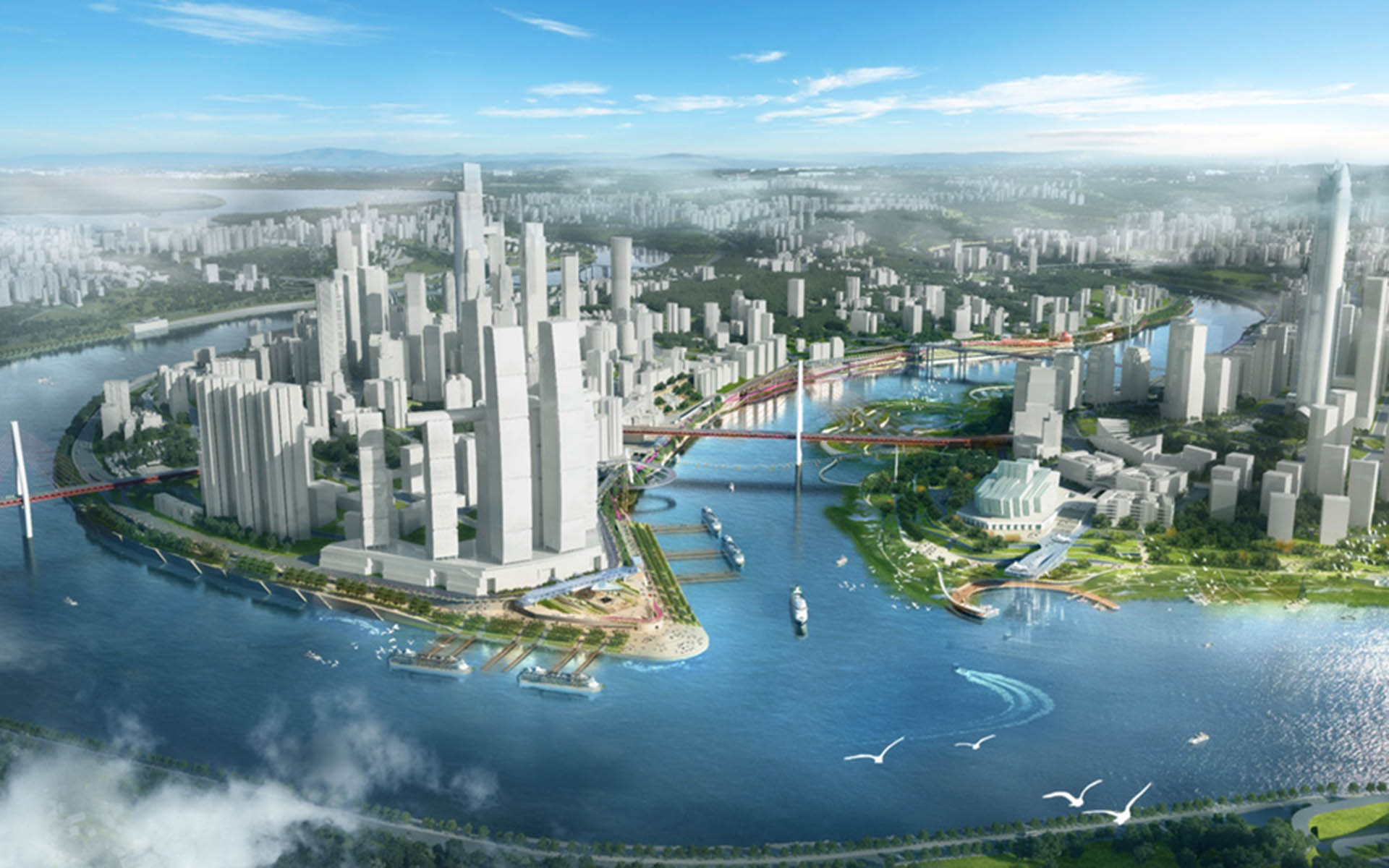
As a mountain city, the characteristics of Chongqing are particularly prominent at the waterfront space. From the 17 ancient city gates to today’s Hongyadong. From a military city that is easy to defend and difficult to attack, Chongqing has transformed into a vibrant western economic centre. Urban construction gradually spread to the riversides and even crossed the city wall to reach the shores, making elevated roads the boundary of the waterfront. But at the same time, it has been not easy for people to access the river. Look at the same distance of 500 meters on the map. If you walk parallel to the shore, it only takes 15 minutes. But if you walk perpendicular to the river bank, it may take an hour.
We thought about how to improve this situation and increase the accessibility from the centre of the city towards the waterfront space. The design starts with 4 aspects: Firstly, the waterfront space is used to reflect the unique urban DNA of Chongqing; then the connection between mountain and water in the city is promoted in a vertical direction; at the same time, a new transportation mode is introduced as an attraction for waterfront activities; the last one is to create iconic features and landscapes for waterfront spaces. This is what we call the edge effect.
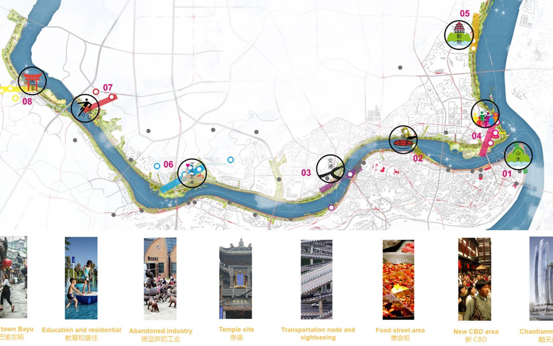
To outreach, is the connection between waterfront and city. Certain urban functions were defined around the nodes. That is the urban DNA. By strengthening traffic connections in the vertical direction, the corresponding DNA functions are extended from within the city and towards the waterfront space to form our eight “Hot magic stripes”.
Each “magic stripe” represents a DNA feature of Chongqing, including the city of Bayu, the city of sport, the city of industry and art, the city of perseverance, the city of multi-culture, the city of transportation, the city of hot pot and the city of mountain and rivers.
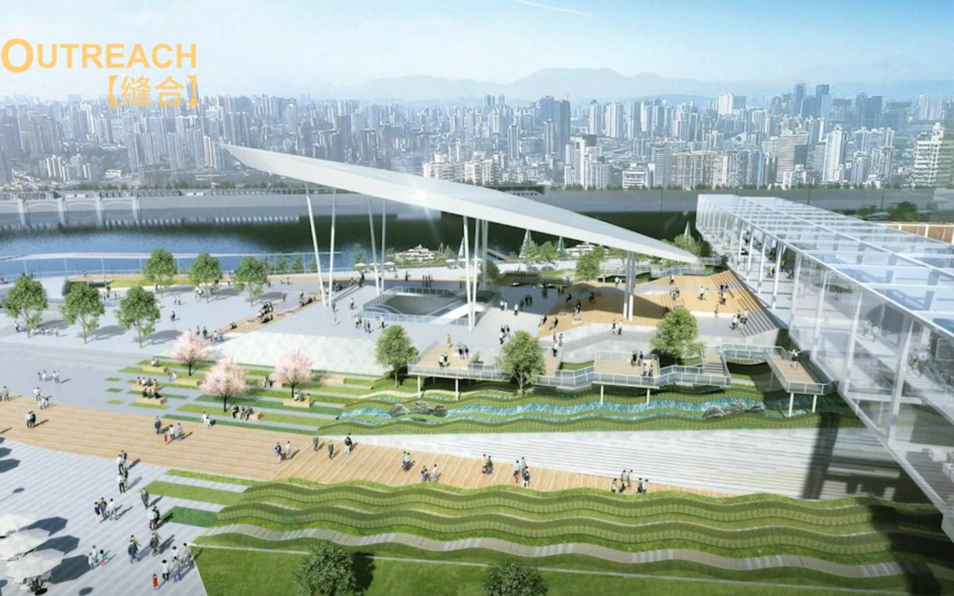
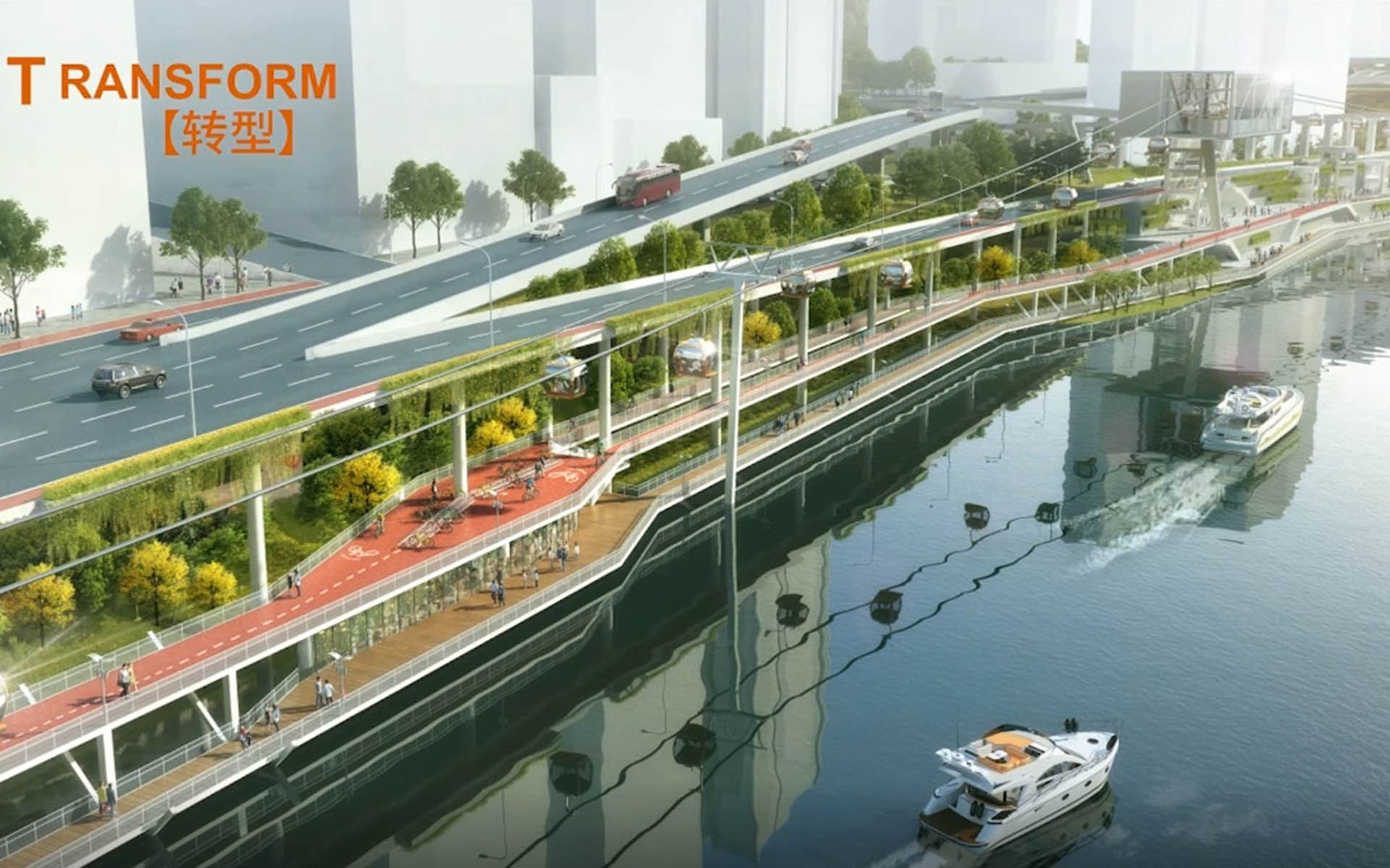
Transform -- LANDSCAPE REGENERATION
The landscape improvement on both sides of the Jialing River, not only aims to create a convenient and shared recreation belt, but also establishes a new name card for Chongqing. The design introduces a 17-kilometer cable car system for the main city, so that people can enjoy the view of Jialing River from a unique perspective.
In addition, the design creates a continuous riverside bicycle and walkway system of 34 kilometers along the riverbank, ending the infamous history of the inability to ride a bicycle in Chongqing. This will also be the first bicycle green belt running through the city center, with well-planned shared bicycle stops.
During the site visits, we found that although Hongyadong is a favourite spot for most tourists and citizens, its transportation and accessibility is very inconvenient, not even featuring a drop-off area. Therefore, we suggest that Binjiang Road should move underground from the west side of Hongyadong, and after going through a underground pathway, use a circular ramp to connect to the existing tunnel. The advantage of this method is, a car-free zone will be created in front of Hongyadong, which not only solves the traffic problems, but also provides people with a direct connection to the riverside viewing platform.
The optimization strategy of the riverbank is based on the existing six typical cross-sections. The ecological restoration is carried out according to the stratification of the water level of the riverbank. Walking relationships between the newly built walkway, bicycle lanes and docks, light rail stations, viaducts and urban interiors are clarified. The designed bicycle lanes and walkways are flexibly interspersed between the transportation facilities, which altogether forms a unique Chongqing-style riverside landscape.
Through the riverside ecological restoration strategy, our design is based on transportation infrastructure and multi-dimensional connectivity to enhance the accessibility of the waterfront activity space, activating the Edge effect of the riverside. By highlighting the eight urban DNA’s which are rich in Chongqing’s culture, we will introduce a variety of waterfront activities to create a brand new waterfront city image for Chongqing.
| Location: | Chongqing, China |
|---|---|
| Type of project: | Waterfront Landscape |
| Project duration: | 2018 - 2019 |
| Program: | Overall landscape design of 35.4 km water shoreline, ecological restoration of the falling zone |