Jiaxing High-Speed Railway New City Underground Space
As cities evolve from horizontal expansion to vertical development, developing underground space in Jiaxing High-Speed Railway New City has become a key solution to balancing space constraints and quality enhancement. Obermeyer, in collaboration with Shanghai Municipal Engineering Design Institute and Yangtze River Delta (Jiaxing) Urban-Rural Construction Design Group, developed an integrated aboveground-underground planning and design scheme centered on "efficiency, aggregation, and vitality" a plan recently approved by the local government.
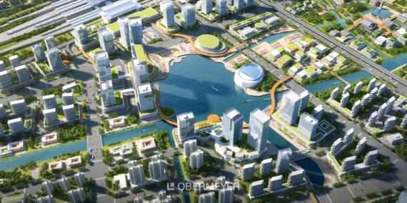
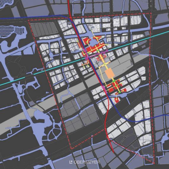
Obermeyer conducted extensive research covering about 50 square kilometers, focusing on detailed design for the 9.5-square-kilometer core area. This core zone is bounded by South Third Ring Road to the north, Nanbei Lake Avenue to the east, Haiyan Tang to the west, and Yubei Street to the south. Through innovative development planning, Obermeyer transformed the underground area into a vibrant hub complementing aboveground spaces.
Core Strategies
Obermeyer has crafted a modern new urban landmark through three core planning strategies: efficiency, aggregation, and vitality.
- Efficiency: Enabling Smooth Mobility
The underground rapid transit system designed separates through-traffic from local traffic, improving vehicular efficiency while reducing ground-level disruptions and upgrading pedestrian experiences.
- Aggregation: Building an All-Weather Connectivity Hub
An all-weather connectivity hub linking the high-speed rail station’s north/south squares, commercial districts, and office clusters enables seamless transfers regardless of weather.
- Vitality: Shaping a New Regional Landmark
Three-dimensional development around the station square delivers accessible public services. Integrated pedestrian corridors merge the station with the cityscape, while natural elements underground establish a regional tourism gateway and distinctive landmark.
Planning Goals
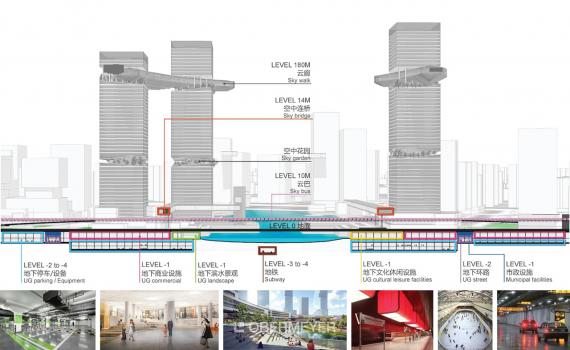
Implementing "Fast Underground, Slow Aboveground," Obermeyer designed four underground systems for Qin Lake CBD’s core:
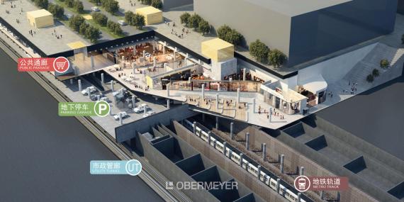
- Underground Traffic System
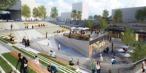
Three-dimensional transportation facilities free up waterfront areas for public use. Smart parking guidance diverts vehicles to underground garages. Beyond serving their primary purposes, the underground garages around Qin Lake add public parking spaces to accommodate commercial and subway-related traffic, easing ground congestion.
- Underground Pedestrian System
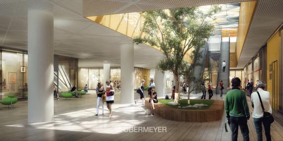
Obermeyer built a 1-kilometer underground pedestrian corridor centered on the high-speed rail hub. Extending south to Jiaxing South Railway Station and north to the intercity station and Qin Lake CBD Station, this corridor connects multiple high-traffic areas, enabling convenient all-weather commuting.
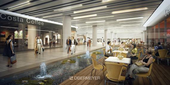
- Underground Commercial Facilities
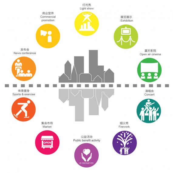
Commercial facilities are strategically placed along the main pedestrian corridor to boost space vitality and maximize the underground value. Meanwhile, public service facilities at key nodes cater to travelers and professionals.
- Underground Municipal Facilities
Relocating energy stations and infrastructure underground minimizes disruptions, supporting sustainable development while highlighting ecological characteristics.
Outlook
Obermeyer optimized transport flow, stimulated urban vitality, and shaped the region’s image. By unlocking aboveground potential through underground innovation, this transit hub evolves into a true city center—a dynamic destination blending station-city integration, multidimensional spaces, vibrant activity, and seamless connectivity.